Magmont Mine
37.6394° N, 91.1222° W · ± 1 km
Marcasite from Missouri, United States, with photos of specimens from this locality.
Minerals found here
Marcasite at Magmont Mine
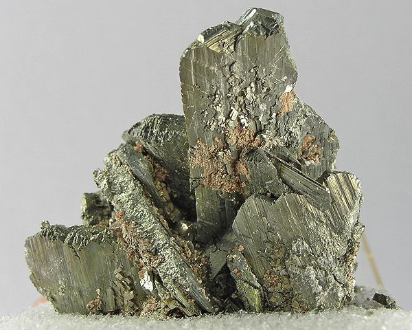
Photo: Robert M. Lavinsky · CC BY-SA 3.0 · Source

- Formula
- FeS₂
- Morphology
- Wide, elongated crystals, mostly complete
- Typical size
- Crystals up to about 4 cm on the pictured specimen
Geology of the locality
- Setting
- Lead-zinc mine in the Viburnum Trend Mining District
- Type
- Hydrothermal
- Host rock
- Dolomite (Upper Cambrian Bonneterre Formation)
- Region
- Missouri
- Country
- United States
Opened 1968 and closed 1994; now part of the Buick Mine complex. Coordinates from the Mindat locality page (DMS converted to decimal).
Sources: SRC-322
Sources
- SRC-322 · Database
Magmont Mine, Bixby, Iron County, Missouri, USAMindat.org - SRC-328 · Website
Wikimedia Commons file page: Marcasite-120531.jpgRobert M. Lavinsky (photographer) · Wikimedia Commons
Draft data from the Provenite workbook. Check entries against the cited sources before relying on them. Photos are open-licence images from Wikimedia Commons; the author and licence are given with each photo.