East Coleman Mine
34.7589° N, 93.0406° W · ± 10 km
Quartz and Rock crystal from Arkansas, United States, with photos of specimens from this locality.
Minerals found here
Quartz at East Coleman Mine
Sharp, glassy, fully terminated crystals, often as floaters without a contact point (based on dealer wording on the photo pages only)
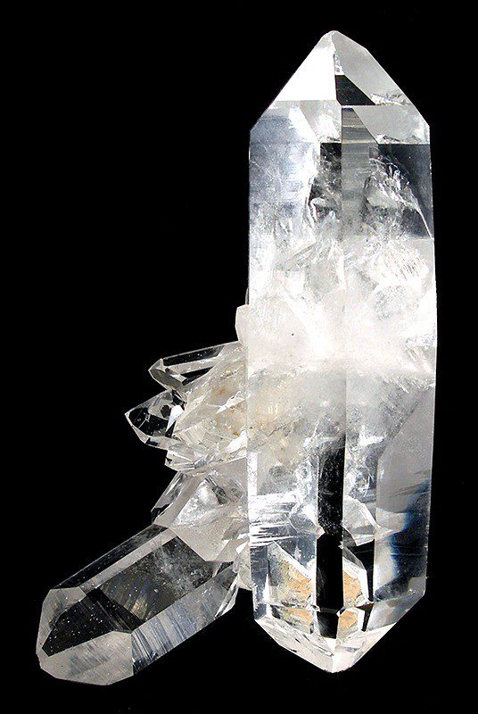
Photo: Robert M. Lavinsky · CC BY-SA 3.0 · Source

- Formula
- SiO₂
- Morphology
- Clusters of clear, terminated points and doubly terminated floater crystals; crystals in the photographed specimens reach about 15 cm
- Typical size
- Photographed cluster specimens about 14-16 cm across, single crystals to about 15 cm
- Color / luster
- Colourless to clear with glassy luster
- Availability
- Commonly available
- History
- Worked as the Blocker Lead No. 4 Quartz Mine and placed under federal control in World War II; the Coleman family has dug here since the 1930s and Ron Coleman has owned the mine since 1987
Rock crystal at East Coleman Mine
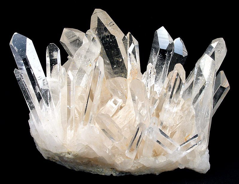
Photo: Robert M. Lavinsky · CC BY-SA 3.0 · Source

- Formula
- SiO₂
- Morphology
- Dense cluster of clear gemmy points rising from a thin matrix plate, longest points about 9 cm
- Typical size
- Photographed specimen about 14.4 x 12.2 x 8.8 cm
- Color / luster
- Colourless, transparent with glassy luster
Geology of the locality
- Setting
- Fissure-filling hydrothermal quartz veins in the Ouachita Mountains quartz belt, formed during the final stage of the Ouachita orogeny roughly 280 to 245 million years ago. The mine is the successor of the Blocker Lead No. 4 Quartz Mine and is now known as the Old or Ron Coleman Mine (other names given on the photo page: West Chance, Dierks No. 4, Geomex).
- Type
- Hydrothermal
- Host rock
- Paleozoic sandstone and shale of the Ouachita Mountains (regional host; the exact host at this mine was not confirmed)
- Region
- Arkansas
- Country
- United States
Coordinates are NOT for the mine itself: no page I opened gives them. They are those of the Blackman Mine, a neighbouring quartz mine about 4 miles NNE of Jessieville, used as a nearby reference point, hence +/- 10 km. Needs a proper check. The mine is a fee-dig site.
Sources
- SRC-174 · Website
File:Quartz-153463.jpg (Wikimedia Commons; quartz, East Coleman Mine)Robert M. Lavinsky · 2010 · Wikimedia Commons - SRC-175 · Website
File:Quartz-153457.jpg (Wikimedia Commons; rock crystal cluster, East Coleman Mine)Robert M. Lavinsky · 2010 · Wikimedia Commons - SRC-089 · Article
Arkansas quartz crystalsArkansas Geological Survey · Arkansas Geological Survey - SRC-176 · Website
Quartz MiningEncyclopedia of Arkansas · Encyclopedia of Arkansas (Central Arkansas Library System) - SRC-177 · Database
Blackman Mine, Jessieville, Garland County, Arkansas, USAMindat.org contributors · Mindat.org
Draft data from the Provenite workbook. Check entries against the cited sources before relying on them. Photos are open-licence images from Wikimedia Commons; the author and licence are given with each photo.