Concepción del Oro
24.6132° N, 101.4205° W · ± 10 km
Azurite and Malachite from Zacatecas, Mexico, with photos of specimens from this locality.
Minerals found here
On the same specimen
Azurite at Concepción del Oro
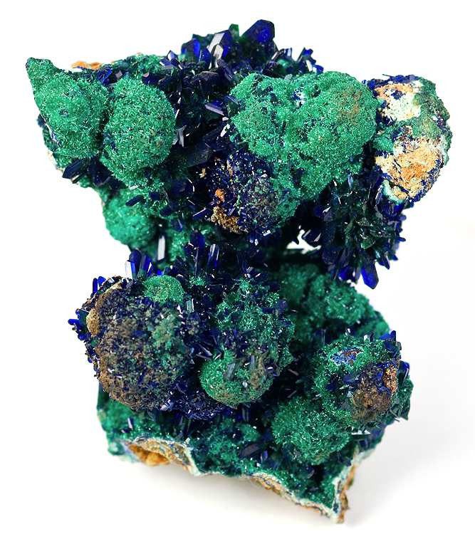
Photo: Robert M. Lavinsky · CC BY-SA 3.0 · Source

- Formula
- Cu₃(CO₃)₂(OH)₂
- Morphology
- Azure-blue crystals on botryoidal malachite
- Typical size
- Specimen about 5 cm
- Color / luster
- Azure blue
- Associated minerals
- Malachite
- History
- Handbook records fine crystals from the El Cobre mine
Malachite at Concepción del Oro
- Formula
- Cu₂(CO₃)(OH)₂
- Morphology
- Botryoidal crusts, carrying azurite crystals on the photographed specimen
- Color / luster
- Green botryoidal malachite beside azure-blue azurite
Geology of the locality
- Setting
- Copper deposits whose oxidized zone is known for fine azurite crystals (El Cobre mine).
- Region
- Zacatecas
- Country
- Mexico
Coordinates are those of the town of Concepcion del Oro (Wikipedia municipality article, elevation 2,070 m). The Mindat entries for Cata Arroyo Mine (about 24.60 N, 101.43 W) and Tajo Mine (about 24.63 N, 101.42 W) lie several km south of the town, hence the +/- 10 km accuracy. Coordinates: Town of Concepción del Oro (NGA GeoNames populated place); mines lie within a few km (Mindat's Cata Arroyo Mine at 24.6044, -101.4269 is 1.3 km from the town). Coordinates: Town of Concepción del Oro (NGA GeoNames populated place); mines lie within a few km (Mindat's Cata Arroyo Mine at 24.6044, -101.4269 is 1.3 km from the town). Coordinates: Town of Concepción del Oro (NGA GeoNames populated place); mines lie within a few km (Mindat's Cata Arroyo Mine at 24.6044, -101.4269 is 1.3 km from the town).
Sources
- SRC-228 · Book
Handbook of Mineralogy - AzuriteAnthony, J.W.; Bideaux, R.A.; Bladh, K.W.; Nichols, M.C. · 2005 · Mineralogical Society of America - SRC-242 · Website
File:Azurite-Malachite-193802.jpg (Concepcion del Oro)Wikimedia Commons / R. M. Lavinsky · 2010 · Wikimedia Commons (opened via Russian-language mirror) - SRC-295 · Website
NGA GeoNames: Concepcion del Oro (feature 3215211) - SRC-284 · Website
File:Azurite-Malachite-193802.jpg (Wikimedia Commons file page, read via a mirror)Robert M. Lavinsky (photographer); page mirrored from Wikimedia Commons · 2010 · Wikimedia Commons - SRC-285 · Database
Cata Arroyo Mine, Concepcion del Oro, Zacatecas, MexicoMindat.org · Mindat.org - SRC-286 · Database
Tajo Mine, Concepcion del Oro, Zacatecas, MexicoMindat.org · Mindat.org

Draft data from the Provenite workbook. Check entries against the cited sources before relying on them. Photos are open-licence images from Wikimedia Commons; the author and licence are given with each photo.